Link to Google Maps: http://maps.google.ca/maps
The following is a link to the Perry-Castaneda Library (PCL) Map Collection at the University of Texas (approx. 50,000 on-line maps from around the world): http://www.lib.utexas.edu/maps/americas.html
Next is a link to the One World – Nations Online website which provides useful summary information for each country (geography, history, ethnic make-up, economy, etc.) including links to some smaller scale maps:
http://www.nationsonline.org/oneworld/index.html
Country & State Maps – below are links to smaller-scale (quick download) online maps for specific regions and countries along our route. Note that maps for individual cities in these countries can normally be found below the country maps listed at the PCL map collection site – see: http://www.lib.utexas.edu/maps/americas.html
Washington State: http://www.wsdot.wa.gov/Publications/HighwayMap/view.htm
Other US States: http://www.state-maps.org/
Latin America: http://www.lib.utexas.edu/maps/americas/latin_america.gif
Mexico: http://www.lib.utexas.edu/maps/americas/mexico_pol97.pdf
Mexico – State & City maps: http://www.lib.utexas.edu/maps/mexico.html#statesites.html
Central America & Caribbean (political & relief maps): http://www.lib.utexas.edu/maps/americas/central_america_ref_2010.pdf
http://www.lib.utexas.edu/maps/americas/central_america_ref02.pdf
Belize: http://www.lib.utexas.edu/maps/americas/belize_rel_03.pdf
Guatamala (political & relief maps): http://www.lib.utexas.edu/maps/americas/guatemala_pol00.pdf
http://www.lib.utexas.edu/maps/americas/guatemala_rel00.pdf
El Salvador: thttp://www.lib.utexas.edu/maps/americas/el_salvador_rel_1980.pdf
Honduras: http://www.lib.utexas.edu/maps/americas/honduras_rel_1985.pdf
Honduras City Maps: http://www.lib.utexas.edu/maps/honduras.html
Nicaragua (political & relief maps): http://www.lib.utexas.edu/maps/americas/nicaragua_pol_97.pdf
http://www.lib.utexas.edu/maps/americas/nicaragua_rel_97.pdf
Costa Rica (political & relief maps): http://www.lib.utexas.edu/maps/americas/costa_rica_pol_1987.pdf
http://www.lib.utexas.edu/maps/americas/costa_rica.gif
Panama (political & relief maps): http://www.lib.utexas.edu/maps/americas/panama_pol_1995.pdf
http://www.lib.utexas.edu/maps/americas/panama_rel_1995.pdf
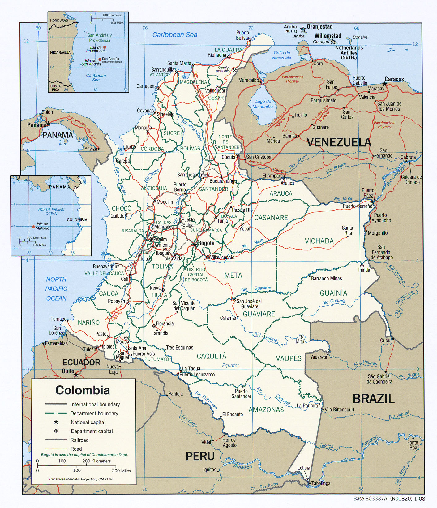
Colombia (political & relief maps): http://www.lib.utexas.edu/maps/americas/txu-oclc-256488229-colombia_pol_2008.jpg
http://www.lib.utexas.edu/maps/americas/colombia_rel_2001.pdf
Equador: http://www.lib.utexas.edu/maps/americas/ecuador_rel_1991.pdf
Peru (political, relief & administraive division maps): http://www.lib.utexas.edu/maps/americas/peru_pol_06.pdf
http://www.lib.utexas.edu/maps/americas/peru_rel_06.pdf
http://www.lib.utexas.edu/maps/americas/peru_admin_06.pdf
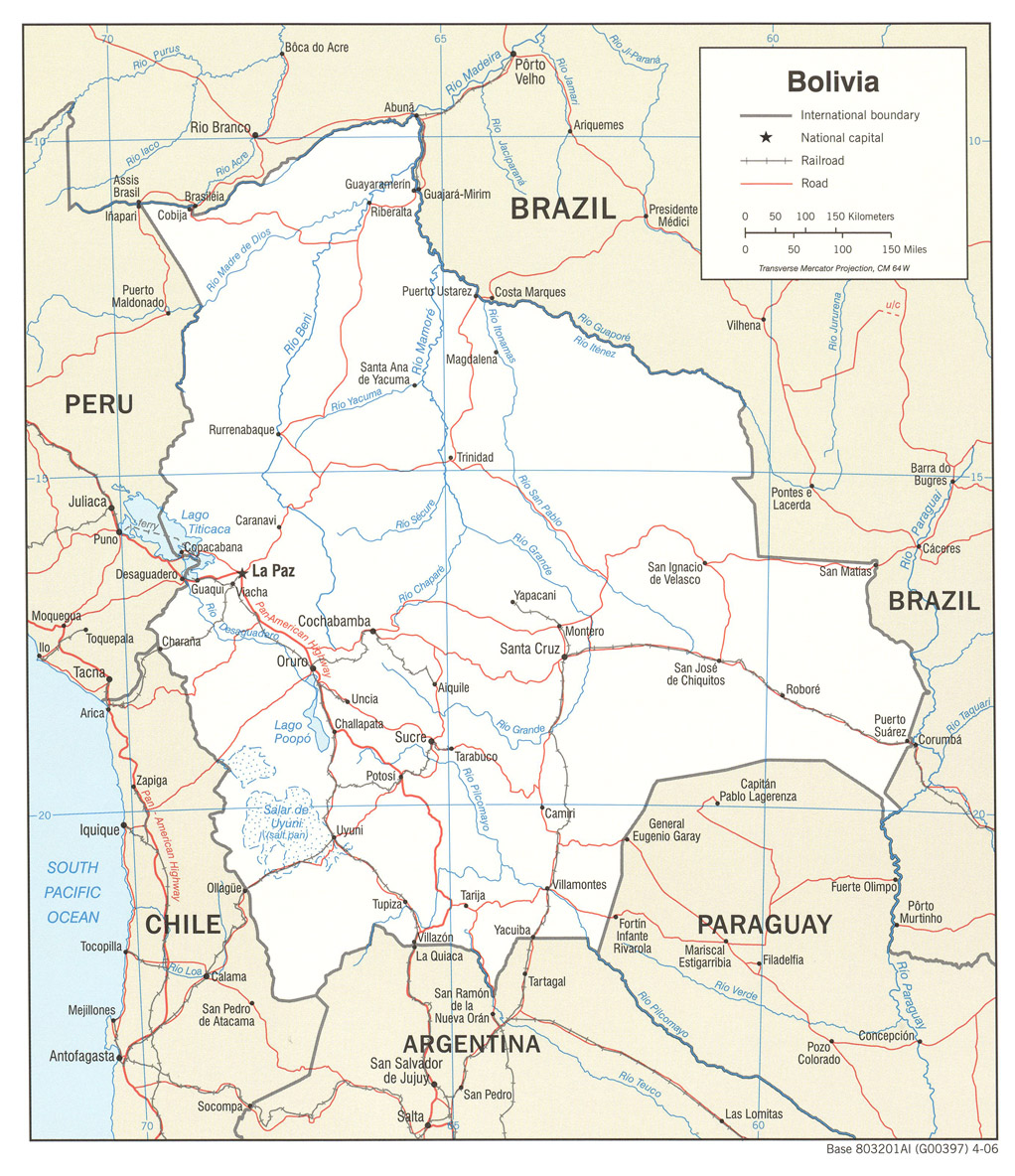
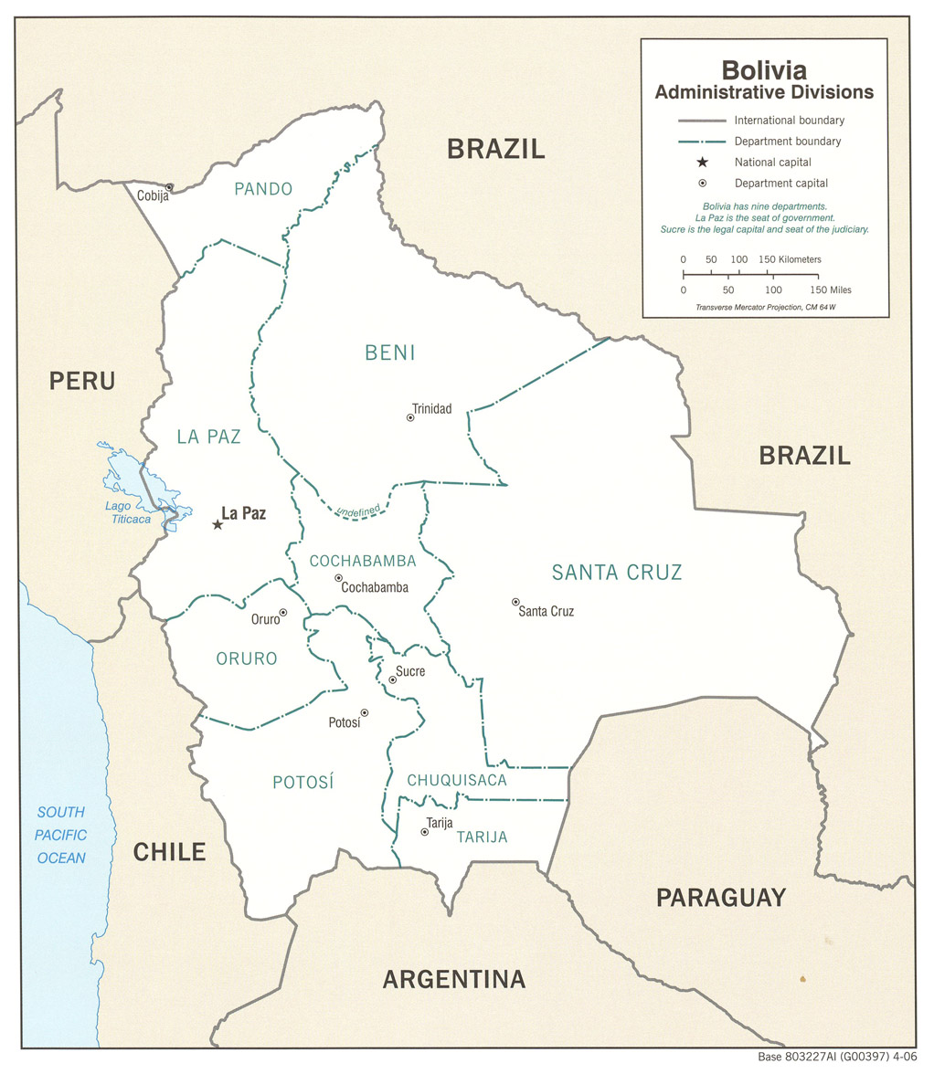
Bolivia (political, relief & administraive division maps): http://www.lib.utexas.edu/maps/americas/bolivia_pol_2006.jpg
http://www.lib.utexas.edu/maps/americas/bolivia_rel_2006.jpg
http://www.lib.utexas.edu/maps/americas/bolivia_admin_2006.jpg
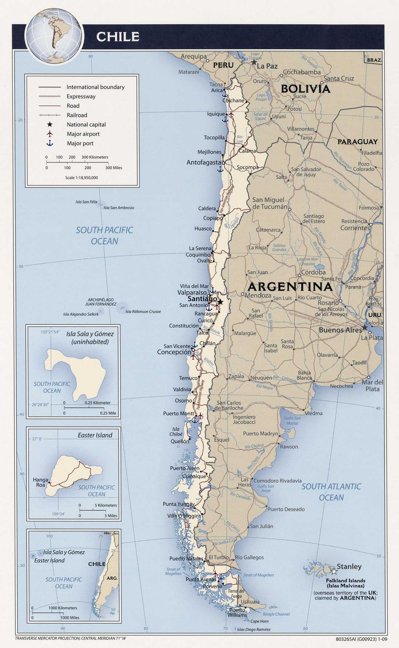
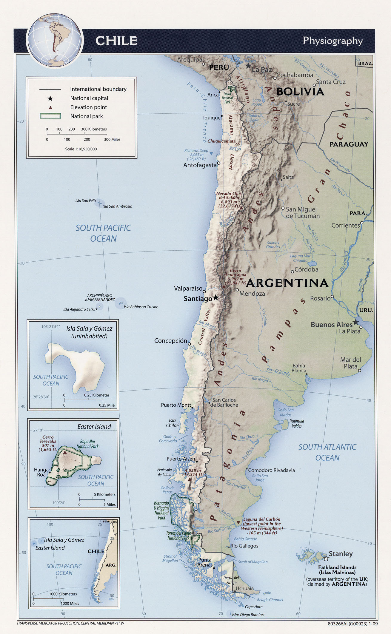
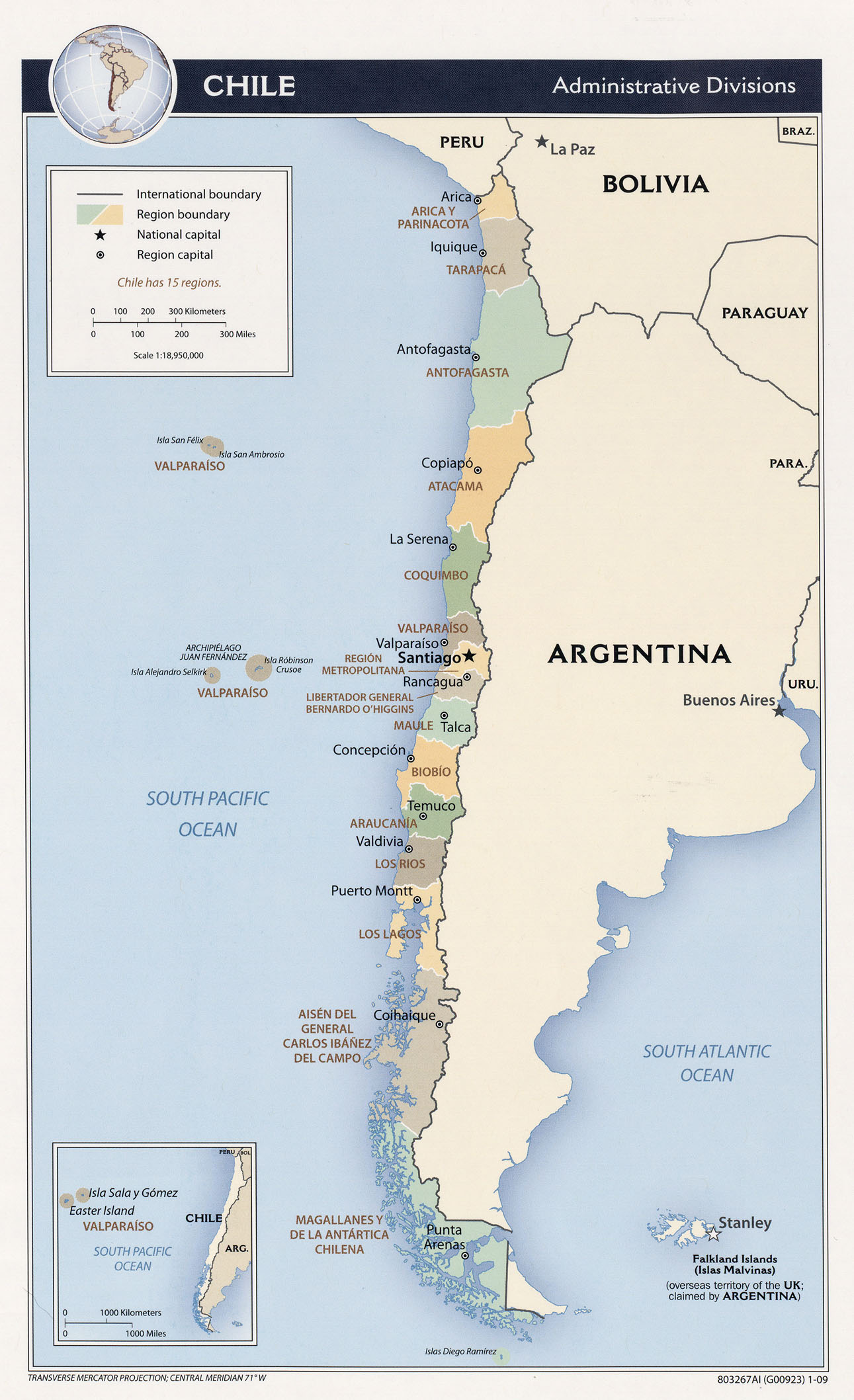
Chile (political, relief & administraive division maps): http://www.lib.utexas.edu/maps/americas/txu-oclc-310606103-chile_pol09.jpg
http://www.lib.utexas.edu/maps/americas/txu-oclc-310606108-chile_rel09.jpg
http://www.lib.utexas.edu/maps/americas/txu-oclc-310606106-chile_adm09.jpg
Argentina (political, relief plus Tierra del Fuego & Buenos Aires):
http://www.lib.utexas.edu/maps/americas/argentina_pol_1996.pdf
http://www.lib.utexas.edu/maps/americas/argentina_rel_1996.pdf
http://mappery.com/maps/Southern-Tip-of-South-America-Map.gif
http://www.welt-atlas.de/map_of_buenos_aires_9-70
Uruguay (political & relief maps):
http://www.lib.utexas.edu/maps/americas/uruguay_pol_1995.pdf
http://www.lib.utexas.edu/maps/americas/uruguay_rel_1995.pdf
Brazil (political & relief maps):
